3 giorni · Tappa 1
Casale Monferrato→Sezzadio
On the streets of Aleramo
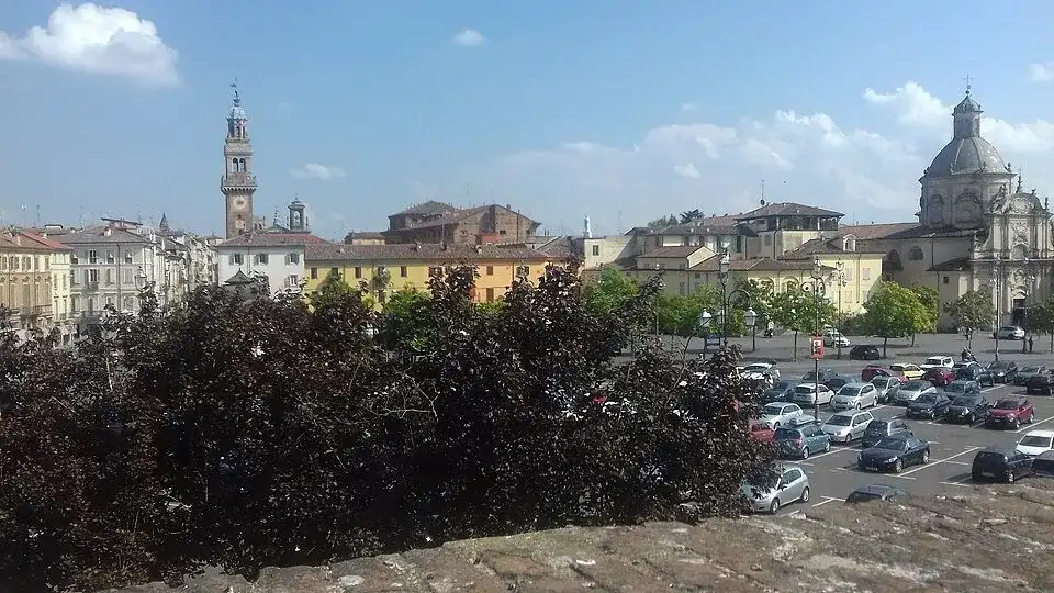
Vista della citta' di Casale Monferrato dagli spalti del Castello dei Paleologi · a place along the route · Sources and credits
There’s more to discover after the trail
All experiencesMeetings, tastings and activities to complete your day in Monferrato and the surrounding area.
Affiliate links: if you book through these links, MonferratoTrails may receive a commission at no extra cost to you. GetYourGuide handles booking, payment and support.
Interactive track
Route map
3 giorni · tappa 1
Linear stage from Casale Monferrato to Sezzadio, 71.6 km and +546 m difference in altitude: the three-day sporting variant of the journey from the Monferrato hills to the sea. From the Paleologi castle you reach Grazzano Badoglio, Fubine and Oviglio, ending at the abbey of Santa Giustina at Sezzadio.
Description of the route
The first day of the Strade di Aleramo leaves Casale Monferrato from the Castello dei Paleologi and immediately connects the history of the city with the open landscape of the Lower Monferrato. It is the start of the three-stage version, the one designed for those who want to cross the entire corridor in a sporty way that leads from the Piedmont hills to the Ligurian sea. The 71.6 kilometers require continuity, but the difference in altitude of 546 meters is distributed in a legible alternation of undulations, descents and smoother sections.
Leaving Casale, the route enters the agricultural plot of the hills and reaches Grazzano Badoglio, a central place in the Aleramic story. Here the memory of the Marquis Aleramo, traditionally linked to his tomb in the church of Santi Vittore e Corona, gives the journey a dimension that goes beyond performance: you cycle inside a foundation legend, among lands that for centuries have built the identity of Monferrato. The road continues towards Fubine, with wide views of vineyards, fields and villages gathered on the hills.
The second part of the stage progressively changes pace. After the central hills you come across more extended routes, useful for recovering a regular ride before the transition from Oviglio. The inhabited centers become natural points for a stop, to replenish water and to observe how the Monferrato landscape transforms as it approaches the Alessandria plain. Despite being classified as easy from a technical point of view, the route remains a long day: it is best not to expend too much energy in the first half and to keep a margin for the last kilometres.
The arrival at Sezzadio is marked by the abbey of Santa Giustina, one of the strongest monumental references of the itinerary. The complex ideally concludes the first stage and introduces the territory in which legend places the origins of Aleramo. Casale, Grazzano, Fubine, Oviglio and Sezzadio are therefore not simple intermediate points, but successive chapters of a journey that combines heritage, rural landscape and geographical continuity. The track is linear: it is important to plan your overnight stay or transfer from the arrival in advance and keep the GPX available throughout the day.
Places and territories affected
Casale Monferrato · Grazzano Badoglio · Fubine · Oviglio · Sezzadio
On the streets of Aleramo · Casale Monferrato → Sezzadio
Stay before setting off or take a break along the way. Choose your base and spend more time exploring the places on this route.
Choose dates and adults in the widget, then open Booking.com for results.
Find stays for this stagePlaces to stay along the route
Data from the official source. Open the tab