Atlas of Monferrato
Montechiaro d'Acqui: sights, history and trails
Alessandria
- Elevation
- 560 m a.s.l.
- Area
- 17.6 km²
- Demonym
- Montechiaresi
- Patron saint
- Saint George
A closer look
Discovering Montechiaro d'Acqui
Montechiaro d'Acqui (Muncior in Piedmont) is an Italian municipality of 511 inhabitants[1] from the province of Alessandria, in Piemonte.
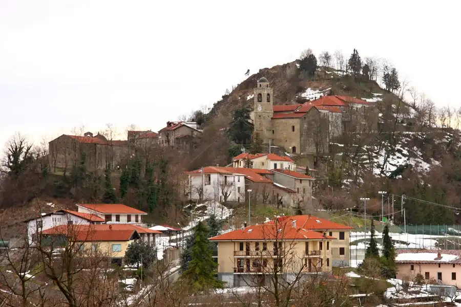
The municipality is divided clearly into two parts: the hamlet Piana at the bottom of the valley, crossed by the Highway 30 of Val Bormida Alessandria-Savona (the most populated area, rich in shops and productive activities) and the historic village of Montechiaro Alto, seat of the municipality, perched on a hill where an ancient castle was destroyed in the seventeenth century by the Spagnoli. The village Alto is still very suggestive today thanks to its cobbled streets, ancient buildings, sandy staircases and beautiful views of the valleys of Erro and Bormida di Spigno.
History of Montechiaro d'Acqui
SymbolsExplore this chapter
The first traces of the town are found near the so-called Pieve del Cauro (7th century), currently in ruins just outside the hamlet of Piana - in all probability the statio of Crixia along the Roman Via Aemilia Scauri — under the influence of the Abbey of San Quintino Spigno Monferrato.
Starting from the 11th-XIII century, with the increase of traffics to the sea along the paths of ridge and for the necessity of a greater defense, the current medieval village of Montechiaro Alto (Mons Cauri). In this period, the Marquis Delfino del Bosco donated Montechiaro to Alessandria and the inhabitants swore submission. However, already in 1284 the inhabitants linked themselves to the Del Carretto family by stipulating a treaty.
After the death of Filippo Maria Visconti (1447) Montechiaro was occupied by Francesco Sforza's troops and in 1454 he was ceded to the Del Carretto di Bossolasco, who passed it to the Scarampi di Cairo Montenotte. The Marchesi di Canelli, the Scarampi-Crivello, the Cavoretti di Belvedere and the Gianazzo di Pamparato, who retained the fief even after the oath of loyalty to the House Savoia in 1736. From this date it was part of the Kingdom of Sardinia, the Kingdom of Italy and finally of the Italian Republic.
Situated along one of the direction of passage between the Padana plain and the port of Savona, the municipal territory has undergone the passage of the armies engaged in the Thirty Years' War (battle of Mombaldone between Franco-Saudi and Spanish, 1637) and in the Italian Campaign (1796-1797) by Napoleon Bonaparte. During the Second World War, the municipality saw the unfolding of the activities of partisan groups in contrast to German troops and the Italian Social Republic.
Montechiaro was home to adoption and Buen retire by great painters of the twentieth century (Eso Peluzzi, Alberto Caffassi).
Symbols
The coat of arms and gonfalone of the municipality of Montechiaro d'Acqui were granted by decree of the President of the Republic of 31 March 1983.[4]
The gonfalone is a drape party of yellow and red.
What to see in Montechiaro d'Acqui
Nature and hikingExplore this chapter
In the parish church of San Giorgio there is a carved wooden pulpit and a Madonna 18th century Maragliano school. The ancient church of the Baptists (XVI century) is now used as a small Contadino Museum that collects artefacts, objects and equipment of the local rural civilization. In the ancient village it is possible to see the old tavern and some memories of the painter Eso Peluzzi.
Isolated under the Bricco delle Forche there is the sanctuary of Madonna della Carpeneta, built 18th century around a 16th-century pylon which still exists a fresco depicting the Our Lady of Mercy.
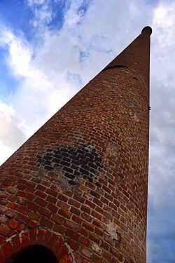
In the hamlet of Piana, located in the valley of the Bormida di Spigno, you can admire the ruins of ancient Pieve and the Church of S. Early 20th century Anna containing an ancient baptismal font of medieval times (X century). In the middle of the town stands the imposing chimney, the last heirloom of the brick factory and its oven (early 20th century). Of interest in the architectural style can be remembered "Villa Veirana" (situated in the polysportiva-ciminiera area) and "Villa Anna", the first in liberty style years '30 and the second of early 20th century.
A characteristic place for a moment of relaxation and peace immersed in nature is the green area of the "Laghetti", derived from the former clay material quarry for the manufacture of bricks, which became in the nineties a park with two artificial ponds.
Nature and hiking
There are two trekking routes marked by CAI and the municipal territory Province of Alessandria, on the site:Acquese Paths Archived on 18 May 2013 at the Wayback Machine..
The routes provide passages in wetlands and with gudes, before embarking on the excursion, it is recommended:
- adequate equipment and systems for geolocation and orientation,
- the communication of the course (present areas where the cellular signal is absent),
- request preventive information about the travelability and weather situation on the route track
| Description | Identification | Level | Extension | Events | Period of travel | Additional paths | Departure | Altimetric profile |
|---|---|---|---|---|---|---|---|---|
| Path of the Calanchi ring | 573 | E | 30 km | 1st Sunday of May - Montechiaro sports club | Spring - Autumn | During the organized excursion, there is a variation of 15 km and an integration of the route that allows the visit of the ruins of the Castle, located in the village. | Multifunctional shed, ex-Fornace area. | 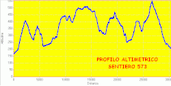 |
| Alpine Trail | 577 | E | 12 km | 4th Sunday of April - Alpini Montechiaro section | Spring - Autumn | Further extension of km6 between the woods and the stretches bordering the municipality of Cartosio. | Piazzale in front of the church of S.Anna | 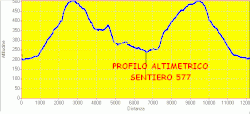 |
Society
Demographic evolution · Institutions, bodies and associationsExplore this chapter
Demographic evolution
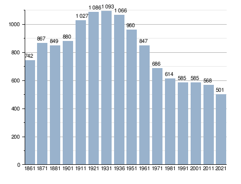
The demographic evolution of the country has been largely reduced during the last century, in particular with the concentration of 2/3 of the inhabitants in the hamlet Piana, located in the valley floor, and the remaining 1/3 divided between the countryside and the village on the top of the hill.
During the thirties of the twentieth century the municipality was joined with the nearby village Denice creating the Municipality of Montechiaro-Denice. This territorial entity lasted until the end of the 1940s when the two original municipalities returned autonomous.
Inhabitants registered[5]
Institutions, bodies and associations
In the municipal territory there are several associations that animate the activities and events present during the year.
- National Alpine Association (A.N.A.) - Section of Montechiaro d'Acqui
- Polisportiva Montechiaro
- ProLoco
Culture
Festivals and traditions · FilmsExplore this chapter
Festivals and traditions
The trade of anchovies under salt, historical activity of the municipality, is re-evoked in the annual feast ofAnciuada der castlan, the first Sunday of May in Montechiaro Alto. On that same day, the solemn religious procession of the Confraternity of Santa Caterina takes place, which guards the venerated relic of the Holy Thorns.
Every year on August 12, in the hamlet Piana takes place the annual Fera (dialect term for fair and exhibition of local products), the main event for the negotiation of cattle, the only one in the province of Alessandria. This event takes up a tradition already described in the 19th century texts by Goffredo Casalis. This event also extends into the winter period with the Fera of Bue Grasso", held every year on December 8, feast of the Immaculate Conception.
Films
Some scenes of the film were filmed on the municipal territory Partisan Johnny (2000) by Guido Chiesa, inspired by the novel of the same name by Beppe Fenoglio.
Infrastructure and transport
Roads · Railways · Internet connectionExplore this chapter
Roads
Montechiaro d'Acqui is located along the Provincial Road 30 of Valle Bormida.
Railways
Montechiaro d'Acqui is equipped with a railway station, of category bronze post on the railway line Alessandria- Saint Joseph of Cairo, called Montechiaro-Denice Station and located within the hamlet of Piana.
Internet connection
Currently the municipality is included among the areas with greater digital gap of the national territory for ADSL wired connections. Since 2014 local service operators have been providing data connection services through the use of Hyperlan radio bridges, providing comparable standards with those present in large housing centres.
News
Bio-directo "Suol d'Aleramo"Explore this chapter
Bio-directo "Suol d'Aleramo"
The municipality of Montechiaro d'Acqui is part of the project for the creation and development of the first regional bio-district. The territory, having been little industrialized and traditionally called for to agriculture, lends itself to a natural indulgence of the rhythms and techniques not invasive in agricultural.
Administration
Twinning · Other administrative informationExplore this chapter
Below is a table relating to the administrations that have succeeded one another in this municipality.
| Period | First citizen | Match | Load | Notes | |
|---|---|---|---|---|---|
| June 26, 1985 | June 12, 1990 | Giovanni Nani | Italian Democratic Socialist Party | Mayor | [6] |
| June 12, 1990 | April 24, 1995 | Giovanni Nani | Italian Democratic Socialist Party | Mayor | [6] |
| April 24, 1995 | June 14, 1999 | Giovanni Nani | centre-left | Mayor | [6] |
| June 14, 1999 | June 14, 2004 | Giovanni Nani | civic list | Mayor | [6] |
| June 14, 2004 | June 8, 2009 | Angelo Maria Cagno | civic list | Mayor | [6] |
| June 8, 2009 | May 26, 2014 | Giovanni Pietro Nani | Lista civica: Per Montechiaro | Mayor | [6] |
| May 26, 2014 | May 27, 2019 | Angelo Maria Ambrogio Cagno | Civic list Tradition Innovation | Mayor | [6] |
| May 27, 2019 | June 9, 2024 | Matteo Monti | Civic list Tradition Innovation | Mayor | [6] |
| June 9, 2024 | in office | Matteo Monti | list of cities in Montechiaro | Mayor | [6] |
Twinning
 Aspremont, since 2003
Other administrative information
In 1929 the town was suppressed and its territory aggregated to the municipality of Denice in the neoconstituito commune of Montechiaro Denice. Montechiaro will regain its autonomy in 1946[7]. During the Kingdom of Italy the municipality was part of the district of Acqui from 1859 until its suppression in 1926. For a year it was then part of the district of Alessandria, until the suppression of the district bodies in 1927. It was part of the district of Spigno Monferrato.
Notes
Explore this chapter
- ^ to b Monthly demographic balance for the year 2026 (provisional data), up demo.istat.it, ISTAT.
- ^ Seismic classification (XLS), up risks.protezionecivile.gov.it.
- ^ Table of degrees/day of Italian Municipalities grouped by Region and Province (PDF), in Law 26 August 1993, n. 412, annex A, National Agency for New Technologies, Energy and Sustainable Economic Development, 1 March 2011, p. 151. URL consulted on 25 April 2012 (archived fromoriginal url on 1 January 2017).
- ^ Montechiaro d'Acqui, decree 1983-03-31 DPR, concession of coat of arms and gonfalone, up Central State Archive. Retrieved 30 October 2021.
- ^ Data taken from:
- Resident population of the municipalities. Censuses from 1861 to 1991 (PDF), up ebiblio.istat.it, ISTAT.
- Resident population - Time series, up exploredati.istat.it.
Please note: 2021 data refers to permanent census data as of December 31 of that year.
- ^ to b c d And f g h the http://amministratori.interno.it/
- ^ Administrative history of Montechiaro d'Acqui, up elesh.it.
Where to stay · Montechiaro d'Acqui
Find stays on Booking.comThe area, step by step
Trails and routes in Montechiaro d'Acqui

Asti, Alessandria and surroundings
Acqui Terme e la Valle dell’Erro
