Casalese area · Walking
Sentiero vignale - san lorenzo
One of our 100 highlights ↗Giardini pubblici sotto Palazzo Callori, Vignale Monferrato
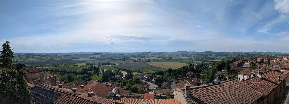 Around the starting point · Photo credits
There’s more to discover after the trail
All experiencesMeetings, tastings and activities to complete your day in Monferrato and the surrounding area.
Affiliate links: if you book through these links, MonferratoTrails may receive a commission at no extra cost to you. GetYourGuide handles booking, payment and support.
About the trail
The gardens below Palazzo Callori open a tour through the vineyards and valley floors of Vignale. The San Lorenzo path shows the agricultural side of the village, between vegetable gardens, farmhouses and rows, with a succession of descents and ascents that continually renews the point of view.
What to look out for
The exit from the center passes through Articiuchera, the area of the artichoke gardens, and through piazza Peisa. You descend towards Cascine Merli and Interzenga, before returning to the slopes of Cascine Coste. In Valle San Pietro white poplars appear; Cascina Boschetto accompanies the ascent to San Siro. The stretch between the vineyards of San Lorenzo leads to Croce Missionaria. Beyond Cascina Pomera, a new valley floor prepares the final climb towards Vignale and Palazzo Callori.
- Vignale
- Palazzo Callori
- Articiuchera
- piazza Peisa
- Cascine Merli
- Interzenga
- Cascine Coste
- Valle San Pietro
- Cascina Boschetto
- San Siro
- San Lorenzo
- Croce Missionaria
- Cascina Pomera
Start and practical details
The loop starts from the public gardens below Palazzo Callori and measures 9.61 kilometres, taking approximately two and a half hours. It alternates asphalt, gravel and dirt road, with short stretches on the provincial road. It is also suitable for MTB, with challenging passages: repeated ascents count for more than distance alone.
The GPX file downloads directly to your device.
Your day on the trail
Check the weather and any closure notices before setting out. Bring water and suitable equipment, follow signs and respect the places you visit.
Trail source: Provincia di Alessandria ↗
Source checked on September 27, 2026
More trails to discover


Experiences from the trail
No published reviews yet. Share your experience.
Sign in to share photos, reviews and outings. Sign in →