Anello 2
Gavi→Gavi
The Streets of Coppi
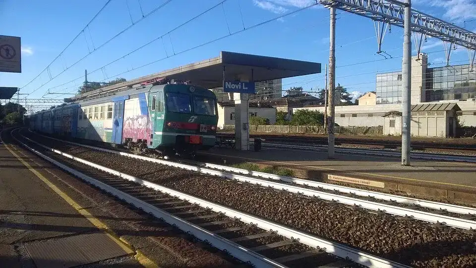
Stazione di Novi Ligure (2) · a place along the route · Sources and credits
There’s more to discover after the trail
All experiencesMeetings, tastings and activities to complete your day in Monferrato and the surrounding area.
Affiliate links: if you book through these links, MonferratoTrails may receive a commission at no extra cost to you. GetYourGuide handles booking, payment and support.
Interactive track
Route map
Path 2
Ring with departure and arrival at Gavi, 69.7 km and +869 m of altitude difference: one of the three rings dedicated to the streets that were Fausto Coppi's training ground. From Gavi you can reach Voltaggio and the Eremiti pass; the return passes through Basaluzzo, Novi Ligure, Villa Coppi and Tassarolo.
Description of the route
The Gavi ring develops 69.7 kilometers and 869 meters of climb, with an approximate time of five hours and thirty-five minutes. It is a wide route, almost entirely road, which connects the village and its vineyard landscape with the Apennine valleys, Novi Ligure and the places of Torpia's memory. The profile rises from the lowest point, located at 129 metres, up to 736 meters in the Eremiti sector: this altimetric excursion is the key to understanding the character of the day.
From the square of Gavi you cycle towards Voltaggio and progressively gain altitude up to the Eremiti pass. It is the stretch that gives the itinerary its most mountainous appearance, with a long climb to tackle without using up your energy too soon. Once past the highest point, the route changes pace and returns towards the hilly altitudes, offering a very varied interpretation of the territory between the Gaviese and the gates of the Apennines.
The second half passes from Basaluzzo and reaches Novi Ligure, where the reference to Villa Coppi once again links the ride to the history of the Campionissimo. From Novi the track heads towards Tassarolo and completes the return to Gavi. The official sheet indicates a composition of the surface that is almost entirely road, with 97.54% classified as road and a small share of asphalt distinguished in the Outdooractive survey: the real effort therefore derives above all from the distance, the difference in altitude and the climb to the pass.
The circuit allows you to end the day in the same place as the start, but still requires adequate preparation: helmet, gloves, puncture material, water and prudent energy management. The official source suggests, as possible extensions separate from the main route, the castle villages of Bosio and Lerma and a possible passage from Tagliolo or Rocca Grimalda. To follow the main ring it is preferable to keep the GPX available and check access and road conditions before departure.
Places and territories affected
Gavi · Voltaggio · Hermits · Basaluzzo · Novi Ligure · Villa Coppi · Tassarolo
The Streets of Coppi · Gavi → Gavi
Stay before setting off or take a break along the way. Choose your base and spend more time exploring the places on this route.
Choose dates and adults in the widget, then open Booking.com for results.
Where to stay in GaviPlaces to stay along the route
Data from the official source. Open the tab