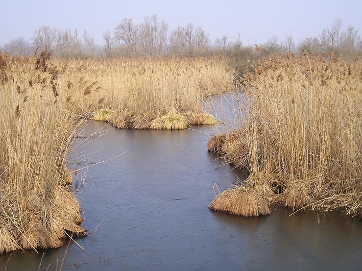
A closer look
Lomellina: at a glance
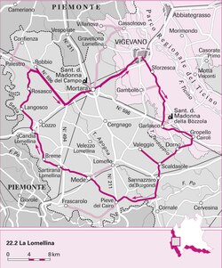
The Lomellina (Lümlína or Lümléna in lomellino dialect, Lomlin-a in Piedmont) is a historical-geographic area of the province of Pavia, in western Lombardy. Lomellina is included between the Sesia to the west, the Po to the west and to the south, the Ticino to the east and the Basso Novarese to the north. Beyond the Sesia it borders with the Vercelli area, to the west of the Po with the Monferrato while at the sundial of the Po with Tortonese and the Oltrepò Pavese. Beyond Ticino, the borders are divided with Pavese and Milanese. The territory has always been with a strong agricultural vocation, it has in the capital Vigevano one of the main industrial centers of northern Italy, as well as historical center of footwear production.
It includes 57 municipalities (214.494 ab.); Vigevano is the most important center. Its name derives from the municipality of Lomello, already municipium Roman and important aggregation center for the territory[1]. Rice cultivation is widespread in the area, as evidenced by the Mortara goods trading hall, the most important in Italy for the buying and selling of rice.
In the course of his history he has long enjoyed several and strong autonomous, as testified by Vigevanasco and the Province of Lomellina.
History
Roman epoca · Middle Ages · Sixteenth and subsequent centuriesExplore this chapter
Although today Lomellina appears as a fairly homogeneous and well-identified region, its formation as a precise historical-administrative entity was the result of a long and complex process, which could only be concluded towards the end of the Middle Ages.
Undoubtedly the Lomellina, within the framework of the Po Valley, had some particular characteristics. Here more than elsewhere the thick wooded coltre that covered the plain during prehistoric times was preserved for a long time: in the Renaissance period the area had vast forests, well known for hunting, which made Lomellina the favourite place for the Lords of Milan.
Roman epoca
This situation probably had not come less even in Roman times, since there is no trace in Lomellina of the centuration that characterizes most of the Po Valley, if not around Vigevano (which constituted a flap of Novara's centuriate campaign), implying the almost safe existence of a inhabited center of some importance near the current municipal territory. The area therefore did not see a deduction of settlers, and the local populations, of pre-Roman origin, suffered a slow and perhaps peaceful process of Romanization during the 1st century BC. The area was not supposed to be ethnically compact in the pre-Roman era: if it is true that the ancient peoples of the Po Valley gathered around the rivers, main routes of communication in the absence of roads, Lomellina had to be the border place and perhaps partial overlap of the peoples who lived along the rivers that surround the area from three parts: the Levi del Ticino, probably founders of the Roman Vigevano[2][3], the Marici of the Po and the Libicii of the Sesia (founders of the first two peoples of Pavia, and the last of Vercelli). These peoples were part of the residual Ligurian Po Valley ethnos; further north, towards Novara, there were people of predominantly Celtic origin (Victimuli, Vertamocori).
The region therefore had urban centres just outside its borders, but it constituted a singularly vast area, for the Po Valley, still deprived in Roman times of important urban centers. This situation was partially changed when the Romans upgraded the road network north of the Po, towards Gaul: Lomellina was crossed by an important road from Pavia, through Duriae (Dorno), Laumellum (Lomello) e Cuttiae (Cozzo), led towards Turin and the Alps (therefore the valleys of the Dora river, Duriae, and the province of the Cottian Alps, Cuttiae). It is significant that the only known ancient centers are known from itineraries and not from literary or epigraphic texts (only Lomello is mentioned in a rather late historical text -355- and always in reference to the road: Ammiano Marcellino, XV.8.18): for the Romans Lomellina was still just an area to cross. However, this does not mean that the local population had not created notable settlements, even if not urban. In this era, Lomellina was probably divided between the municipalities of Vercelli, Novara and, above all, Pavia[4]. The south-eastern part of Lomellina was called Aliana: we speak of a region Aliana inter Padum Ticinumque amnes (Pliny the Elder, Nat. Hist, XIX, 9), famous for its linens. There was also a region nearby Retovina whose name could derive from a place called ♪, perhaps the Redobium of the Middle Ages, that is Robbio.
Middle Ages
A real change took place only in the late antiquity and in the early Middle Ages, following the extraordinary increase of importance of Pavia, which became the capital of Goths, Longobards and Franks in Italy. The relationship with Pavia was crucial to Lomellina, although contradictory and often conflictual. Undoubtedly the first effect was the increase in importance of Lomello, which became a county seat during the Frankish era. Surprisingly the ancient border between Pavia and Vercelli, the old town hall reunited a vast area of the present Lomellina, which for the prestige of what was at that time its main center assumed for the first time this name. The eastern part, however, continued to head to Pavia and other marginal areas in Novara and Vercelli. The relationship of this county with the Ticino city had a rapid and contradictory development: the Counts of Lomello became Counts of the Sacred Palace of Pavia and Conti di Pavia[4], but this Lomellian dominance was reversed almost immediately; Pavia first drove out the Counts, then fought them and finally subdued them (1146). On the other hand, the subjugated Lomellina took on its present-day connotations, since Pavia identified with this name (until then used to define a smaller territory) all its dominions to the west of the city, including both the ancient county of Lomello and the adjacent lands formerly in Pavia, and finally strips of the Vercelli and Novara territories that the powerful municipality of Pavia had conquered. The result is therefore, unlike the nearby Oltrepò, an area equipped with its own aggregation center already before the conquest of Pavia. It should be added that the proximity of other urban centers (Vercelli, Novara, Alessandria and Milan, in addition to the progressive increase of prestige of Vigevano) made less strong the takeover of the capital on the region, especially when the power of Pavia began to decline.
Sixteenth and subsequent centuries
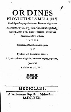
After the viscontea conquest of the Pavese territory, Lomellina was confirmed at the County of Pavia, then elevated to Principato. It is precisely in this period, however, that opens a centuries-old split between the capital and the territory, characterized by strong autonomous[2][3][5][6], which only the unification of Italy would have definitively concluded. It is in fact in 1530 that Vigevano, gets first in Lombardy the city title[without source].[clarify the meaning of the title], as well as being an episcopal seat, being to date the only other city in the province seat of diocese; all on the intercession of Francis II Sforza, last Duke of Milan and exponent of a family historically linked to the city. As a result, the delegates of Vigevano ask the Sforza for an “idoneam et competentm jurisdicionenem”, obtaining as an answer the institution in 1532 of Vigevanasco, autonomous province that would have gathered for over two centuries an important slice of northern Lomellina[6] with some of its main centres: besides of course in Vigevano, Gambolò, Cilavegna and Robbio were also among others. In the 17th century, always within the State of Milan, the rest of Lomellina began to enjoy greater administrative autonomy: first thanks to a Congregation dismissed from that which the remainder of the Principality was chief, resulting in a certain sense "independent" territory.[5], then in 1707, conquered by the Savoys during the War of the Spanish Succession (possession confirmed in 1713 with the Peace of Utrecht), becoming an autonomous province (the Oltrepò was in turn annexed in 1743 and separated from Pavia, but continued to be called Pavese; any reference to the ancient capital was missing in the case of Lomellina). In 1743 the Vigevanasco concludes its centuries-old existence becoming sabaudo territory and, in 1750, its inheritance is collected by the Province of Vigevano. In this way in the modern age there was a narrower idea of Lomellina: only in 1818 the provinces of Lomellina and Vigevano were gathered, with capital the first despite the primacy of the second one, and the name Lomellina reiterated to indicate the entire territory known today by this name.
In 1859, by now at the dawn of national unity, the decree Rattazzi established the meeting of Lomellina and Oltrepò Pavese, already Piedmontese, with the Province of Pavia removed to Austria, in the new province of Pavia, within which the Lomellina district was established, with Mortara as its capital, heir to a centuries-old self-determination of the territory. Since then, any discussion about the reassignment of a new autonomy to the vast Lomellino territory, with the creation of a hypothetical province, has remained confined to a few isolated political figures.
The nature of Lomellina
Nature protection in Lomellina · The doses of Lomellina · GeologyExplore this chapter
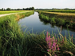
A flat territory like that lomellino does not show, to an occasional visitor, evident signs of environmental heterogeneity. Most of the territory is occupied by crops and seems to have taken away every space from spontaneous plant formations. The soil so flat and uniform would seem to be an original condition, and not, as in reality it is, the result of a centuries-old human action, which has transformed a territory originally constituted by small but perceptible undulations, occupied by a dense and varied vegetation, in order to obtain crop land. In a very short time, the original territory was made up of small undulations, on whose top there was a vegetation characteristic of the arid areas, to which alternation was alternated in which the moisture of the soil was, at times, very pronounced and allowed the development of a luxuriant marsh vegetation. The intermediate areas, which constituted most of the fundamental plane of the plain, were occupied by formations of forests, dominated by the farnia, Quercus robur, and other more or less demanding arboreal species regarding soil moisture. The land reclamation consisted of removing the higher parts of the undulations and placing the soil removed in the lowered areas. This was made in ancient times by very simple means, i.e. with blades and carrioles. In recent decades, more transformations have been made using bulldozers.
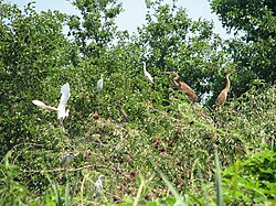
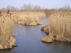
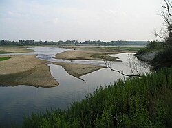
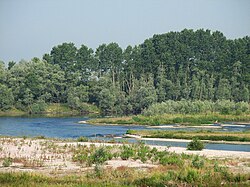
They survive, however, very small areas but of great naturalistic, historical and documentary interest, which show us how the appearance of Lomellina was in past times. These residual areas still contain naturalistic evidence of enormous value, such as plant formations, examples of flora and fauna of great importance also at European level. It is enough to think that in some of the wet forests residues are located the so-called “garzaie”, that is, the colonies of Greek herons, most important in Europe. Very interesting are the golenes of the rivers Po, Ticino, Sesia and Terdoppio, which in some places have preserved natural characteristics of great value. One of the least known peculiarities, even at local level, is represented by dossies. A significant part of the lomellino territory has been included among the priority areas for biodiversity and is one of the important source areas within the Regional Ecology Network of Lombardy.
Nature protection in Lomellina
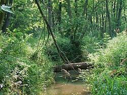
In Lomellina there are several natural reserves and natural monuments, established by the Lombardy Region and two regional parks: the Lombard Nature Park of the Ticino Valley, the first regional park established in Italy in January of 1974, and the Park of Po Vercellese/Alessandrino, of the Region Piemonte. The protected areas of Lomellina exist thanks to the presence of international faunities. Over the years '70 the importance of the populations of colonial herons of the Central-Western Po Valley among the populations of the Western Palearctic, with Lomellina in the centre. Today, in a more complete framework of knowledge, this region is confirmed as one of the richest and most interesting from the ornithological point of view on the continent. This is one of the few areas, perhaps the only one, in which all nine European species of Ardeidi meet, seven of which colonial (Ashion Airone, Red Airone, Large White Airon, Garzetta, Sgarza Ciuffetto, Airone Guardabuoi, Nitticora) and two, Tarabuso and Tarabusino, who nidify in a solitary way. Beside them nest species of absolute conservation interest: Spatola, Mignattaio and Falco di palude. In addition to nesting birds, the natural reserves and natural monuments of Lomellina have proven to be highly relevant biotopes for the conservation of rare and threatened species at European level, among which several included in the priority lists of the Habitat Directive.
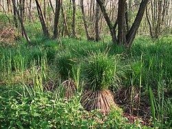
Thanks to the ornithological interest, the most important wetlands were identified by researchers of the Pakistani University as priority and later protected thanks to the application of new regional laws over the years '80. Only several years later, with the transposition by Italy of the Habitats Directive, promulgated by the European Community in 1992, we realized that the choices already made had anticipated much of the understandings of the Directive itself. In particular, the system of protected areas of the Pavese plain included the best examples of wooded formations of Black Ontanus. These, classified as “Reliable alluvial Forces of Alnus glutinosa and Fraxinus excelsior (Alno-Padion, Alnion incanae, Salicion albae)”, are not only included among the habitats of community interest whose presence involves the designation of the area like SIC (City Interest Site), but their conservation is considered a priority. Never as in this case the use of a wildlife group as an indicator of naturalistic value has produced concrete and interesting results on a larger scale.
The doses of Lomellina
The Dossi della Lomellina have attracted the attention of illustrious scholars of natural science since the 19th century. Already in 1882 the geologist Taramelli had taken care of these areas, deepening its study in the following years in some publications (1890). Another famous geologist, Alfredo Boni, for years director of the Institute of Geology at the University of Pavia, studied the dossies, making remarks very detailed. The work was published in 1947, and is still a fundamental contribution to the geology of the Po Valley. The botanical aspects were researched by Francesco Corbetta, the Institute of Botany at the University of Bologna, and the results published in 1968.[without source]
Geology
Less interruptions to flat uniformity and the succession of rich crops in fields, rotting, rice are made up of tiny reliefs that, isolated or groups, are separated from the general plan. Deeply hit remains the one who, abandoned the main road that leads from Tromello to San Giorgio Lomellina, starts for the fields, and then, crossed the rows of poplars that limit the horizon, adventure in the woods towards Cergnago. A completely unsuspected show shows him: the surface, quite sandy, arid, covered with lean herbs, some broom and a forest of oaks and robines, is all flooded by tiny hills, among which are small depressions, where the soil appears damper. All these reliefs are generically indicated on the spot under the name "dossi", and in some cases, to indicate their sandy nature, with that of "sabbioni".
Of course, the dox plates are now very limited in extension and the isolated reliefs little numerous; the reclamation work attacks them continuously, cultivating them first without irrigation, smoothing them progressively, thereby reducing water and thus reducing them to irrigate crops. In memory of man are remembered zones before "doxes" and today spied, irrigated and cultivated with rice. In the topographic paper itself we see in several points the indication "Dossi" in today's flat regions: indeed this fact can help us to reconstruct the distribution of the phenomenon in a historical past. The largest sandy plates in the Lomellina region, and therefore of all Lombardy, where the most evident is primitive morphology, are four: the one that from Remondò to Nord pushes almost to the farms Rabbiosa and Donzellina to the South with a width that goes around the kilometre, a second that from Cergnago extends for a couple of kilometers towards SE until it meets and crosses the road San Giorgio-Tello[without source]
The origin of the doses
Scientifically it is interesting the problem of their origin - if by the wind or current waters - and their age. From this fundamental others derive not less important, such as that of the climatic conditions in which their modelling and that of the lineages of hydrography at the time of their formation. The "doxes" are not a peculiarity of the Pavese section of the Po Valley. Sandy reliefs similar to literature are present in Piemonte (the "sabbioni" of Trofarello-Cambiano and Grugliasco), in Cremonese, in Veronese (dossi), in Padovano (dune), in the Vicentino (motti or motte); these environments are currently very reduced or completely disappeared. Of course, reliefs isolated from a phenomenon of erosion and terrace are expressly excluded and those emerging from the plain as included. In the first edition of its "Geological description of the province of Pavia" (1882) Torquato Taramelli recalls the above-mentioned reliefs, indicating them in the paper annexed under the common name "sabbie dissolved alternating with clay; they form reliefs in the terraced plateau and lean on tertiary formations", and reconnects those of Lomellina with those of Miradolo Terme. He believed that they represented "the remains of a prism of deity coming from the upper valley of the Po, which always continued to tramontana of the current course of this river until it invested the hill of San Colombano; these remains would be eroded and surrounded by more recent floods, dispersed from the streams extinguishing the glaciers of Sesia, Ticino and Verbano". The age of their formation would be according to the Taramelli the ancient diluvium. The Taramelli's conception reiterates in the "Explaination of the Geological Paper of Lombardy" (1890) and adds: "These ocraceous or sandy reliefs represent conoids of rain and deietion independent from the terraced alluvial apparatus, which can refer to the second glacial phase and are therefore preserved where the glaciers were not pushed during this period and where less was The Stella (1895) asserts the nature of continental dunes of these reliefs: "... the ones I marked on paper, both in Lomellina and in Pavese, are true continental dunes " and attributes it to the formation of the Alluvium. The card to which the Stella was alluded, however, remained handwritten and those attached to his later works do not bear indications of the dossies. Soon the Taramelli (1898) accepts the views of the Star on the origin of the dossies, however, attributing its formation to the recent Diluvium. However, the first criticisms, or at least limitations, arise immediately, to the idea of the wind origin of these small reliefs of the plain. The Artini (1898) in fact thus concludes his mining study of the sands of the dossi of Veneto: "Another fact immediately strikes those who examine the samples of these materials, and compare them: the disformity of grain, and the extreme inequality of the diameter of the individual granules components: next to a very fine file are found sandy granules of increasing diameter, and even pebbles of various nature. Now this observation can alone be enough to exclude the doubt that the dossi represent coastline, marine dunes, or continental dunes... My view is that rather the dossi represent the leftovers of natural clay, materials transported and partly smossioused and removed from the torrential fiumana which descends from the glaciers in dissolution, with changing speed, and course capriciously wandering." Nicolis (1898) emphasizes the hypothesis, attributing the formation of these doses to a transition hydrograph from that of rain to that of rain. He admits, however, that "in certain parts of our low region without vegetation, where sands were extended, during a dry climate period, the wind phenomenon could have produced". It is also remembered that the "doxes" are not marked in sheet 58 Mortara of the geological paper of Italy, found, for the plains, by the Stella, while they are in sheet 59 Pavia, detected by the Sacco, and that in folio 63 Legnago, also noted by Sacco, are indicated of "doxes of barren sandy soil, residues of ancient floods". The Cozzaglio (1937) in its "hydro-geological Charter of the Po Valley - region between Adige and Serio" - marks the "fine sands probably winds".[without source]
The shape of the bumps
Unfortunately, only in a few cases we can still recognize the form that the dosso had before the works of agricultural reclamation operated by man in the last centuries. And that's not even said it was the primitive one. Most of these are not the fragments of surface to doxes which are difficult to reconstruct primitive trends, even when the surface itself has not been restructured by material intake or removal, for agricultural work or also for military works. You can still have a discreet vision of the primitive aspect in the aforementioned plaghes of Remondò, of Cergnago-San Giorgio, of Bosco del Lupo, at least in certain points. The surface of the soil, mostly naked or covered mainly by a thicket of robines and roars, presents here the appearance of tiny hills with very irregular patterning, enclosing among them small depressed areas, from the damp bottom, made evident by the greater abundance of herbs, almost small oasis in the tiny sandy desert. This hill reaches a variable height from point to point, but in some cases they also reach 5-6 meters. Their trend is very irregular, so that they can hardly recognize a prevailing direction of alignment: at some point it seems to be able to distinguish a NNE-SSW, in some other more N-S or even NNW-SSE. You can't recognize a quicker flank and less. If it is legitimate to think that the currently detectable forms reproduce at least in part those primitive of these small reliefs, they seem to be able to distinguish two morphological types: that of vast sections of surface shaped like dunes and that of almost isolated undulations of the surface, elongated in a certain direction and slowly degrading in one of the orthogonals. The dossies of the Pavese would seem to correspond to this second type, while in Lomellina they would be present both.[without source]
Origin of forms
Admitted the wind remodelling of sands constituting the plates of Remondò, Cergnago, San Giorgio, Bosco del Lupo etc., it is logical also to admit that the peculiar morphology we meet, is also the product of this wind action: we can not speak of typical dunes in the classic acquisition, missing the possibility of distinguishing a less steep side and a more repudiated wind, Overall, you can't deny a similarity to a typical dune area. Similar reliefs to dunes can be produced from water at bed points and in different circumstances. First of all, we must remember the undulations of a dune that rivers form in their bed; waivers which generally migrate in the sense of the current, but in particular conditions they can also trace it back. Then there are the banks forming in the river when transport of the material is greater and that, following the particular conditions of the movement of water, they form mainly towards the shores. In particular, the benches form within the meanders and continue from one to another separated by a depression.
At the end of the Diluvium, the fiumane deposited in correspondence to the area between Mortara, Cergnago, San Giorgio, Tromello, Gambolò and elsewhere, fine sands mixed with pebbles of considerable size. In the transition period between this hydrography and that of the river, assumed a character different from that previously possessed, formed sand banks more or less fine and more or less mixed with pebbles and natural clays were created. Then the work of erosion and terrace began. There where the sands deposited were finer and formed broader plates, he began, perhaps immediately, maybe after a certain time, the wind remnants. The dust and sands minute and light, if present, were transported further. Medium grains were separated from the pebbles, accumulated and shaped in dunes in a slow process, continued for very long periods. Where instead the sands constituted only of the benches or of the cordons the wind action - if it happened, - was certainly lesser and soon ceased for the protection of the vegetation all actor. The wind reservoir, which would not seem to presuppose climatic conditions clearly different from the current ones, continued at least until the Gallo-Roman era, and perhaps up to the works of hydraulic and agrarian reclamation, when the humidity of the air increased later both to climate changes and to the creation of rottens and rice.[without source]
Vegetation
Much of the dossi has undergone profound alterations in recent times; this makes it difficult to reconstruct the possible vegetal landscape that characterized them in the original conditions. Of the lomellini, however, two, fortunately, even if only in part, are escaped from total destruction. One is the dosso of Remondò in the south side of the Mortara-Pavia road which is now occupied by military installations and that, although partly tampered with, is still sufficiently representative. The other is part of the dossus of San Giorgio - Cergnago, located along the municipal road Cergnago-Tromello, privately owned, destined for a faunal company and that, despite some tampering inherent to its function (excavation, for example, of ponds for hunting water birds), preserves not few still almost intact and of great beauty. Of the first, nowadays almost devoid of original arboreal cover, it was occupied years ago Bertossi (1950) who illustrated several pioneer populations that occur in colonization of sandy soil and proposed a dynamic scheme of vegetation. In the context of the dosso of San Giorgio and Cergnago, instead, the most interesting aspect is offered by the central part, less tampered, all shaped in dunes of poor slope and occupied as well as the whiskers and lichen (predominantly Rhacomitrium canescens, Cladonia furcata and C. endiviaefolia) also from small wooded woods, of surface, in general, very modest. In most cases such lembi do not exceed the size of 40-50 meters for 25-30 The structure of the wood is characterized by the presence of an arboreal layer represented exclusively by Quercus robur, with bored individuals and diameter, at the base, also of 30–40 cm. It follows a shrub layer, low (2-3 meters), usually very rarely, with Crataegus oxyacantha, Rhamnus frangula, Evonymus europaeus and Ligustrum vulgare. In the herbaceous layer, poorly and irregularly represented, they stand above all thick colonies of Polygonatum multiflorum and Polygonatum medicinal. Although in the poverty of their floristic composition, the forests that grow on the bumps provided data that allow to make some considerations and that is that the penetration of Robinia pseudacacia, which also around very vigorously wood, is fortunately very poor and that it seems significant the fact that the more active natural renewal of the Quercus robur moth coincides with the presence of a greater number of species characteristic of the Querco-Fagetea. Of less interest, however, because deeply disappeared from the anthropic intervention, other vegetative aspects and that is the shrubs to broom Cytisus fuckrius and the graminetes open to "barba di capra" Corynephorus canescens or those closed to Carex hirta And Cynodon dactylon.
Fauna
The area of dossi is an island of natural vegetation in the expanse of surrounding crops. There are therefore a suitable environment many species that have now disappeared from most of the Lomellina. As far as there are in-depth research into the faunities, the first data collected on avifauna bear witness to the importance of the biotope in question as an extreme refuge for different species of wood. They are present, sometimes in good number as in the case of anatids, different species palustri thanks to the existence of aquatrini in the event between one dosso and the other. Among the mammals is to be reported the presence of the stink Mushroom putorius, of the marten Martes Mars and the rate Meles meles. Among the amphibians, the Lataste frog should be looked for carefully Rana latastei and the hairy Pelobates fuscus insubricus, for both of which the environmental conditions suitable for existence exist.
Sagre and Events
All the lomellini centers organize every year parties, festivals and poles. The most important events are:Explore this chapter
All the lomellini centers organize every year parties, festivals and poles. The most important events are:
- February: Carnival and parade of floats in the major lomellini centers;
- March: Golden Scarf, Vigevano;
- April: Fiera del Drago, San Giorgio di Lomellina;
- May: Patronage "Santa Croce" second Sunday of May, Lomello
- May: Feast in Cascina, Pieve del Cairo;
- May: Asparagus festival, Cilavegna;
- May: Sagra delle rose, Pieve Albignola;
- May: Historical re-enactment of the Battle of Palestro, Palestro;
- May: Sagra della Cotoletta, Mede;
- June: Art Day, Gravellona Lomellina;
- June: Night of Souls, Gravellona Lomellina;
- June: Historical reconstruction of the wedding of the Longobard Queen Theodolinda, Lomello;
- June: Sagra del Riso, Sannazzaro de' Burgondi;
- June: Sagra della Cipolla Rossa De.Co., Breme;
- June: Sagra dello Spiedino, Torre Beretti;
- June - July: Feast of San Defendente with Palio delle Contrade, Cassolnovo;
- July: Sagra dell'Alborella, Candia Lomellina;
- July: Feast of the Confreres, Gym;
- July: Festival of the Borlotto Bean, Gambolò;
- July: Semiana Jazz, Semiana;
- July: "Anguriando festival", Olevano;
- July and August: Sagra del Buongustaio, Langosco;
- August: Sagra del Salam dla doja, Olevano;
- August: Barceolada Race, Candia Lomellina;
- August: Sagra di San Bartolomeo, Zerbolò;
- August: Sagra dal Strachìn, Lomello;
- september: Sagra della porchetta, Cozzo;
- September: Sagra della sumaca e del riso lomellino, Valle Lomellina;
- September: "Settembre Bozzolese", Garlasco;
- September: "Festa di San Pio X" before Sunday of September, Mortara;
- September: Feast of Our Lady of San Zeno, Gravellona Lomellina;
- September: Palio dl'Urmon, Sagra del Cotechino, Festa città, Robbio;
- September: Sagra della Rana, Sartirana Lomellina;
- September: Anatra Festival, Ceretto Lomellina;
- September: Children's Day, Gropello Cairoli;
- September: Sagra del Riso Novello, Rosasco;
- September: Sagra degli Gnocchi, Vigevano;
- September: Palio d'la Ciaramela, Mede;
- September: Sagra del Mais, Albonese;
- September: Sagra del Risotto with Grand Prix of Risotto, Cergnago;
- September: Sannazzarese, Sannazzaro de' Burgondi;
- September: Sagra del Salame d'oca di Mortara, Mortara;
- September: Palio del gioco dell'oca, Mortara;
- september: Exhibition of Antiques, Sartirana Lomellina;
- October: Palio del Marenghìn, Candia Lomellina;
- October: Feast of the Offelles, Parona;
- October: Palio delle Contrade, Vigevano;
- October: Sagra della Zucca Bertagnina, Dorno
- October: Chiodino mushroom festival, Cilavegna
- October: Feast of La Fumm, Goido
- October: Autumn Day, Cassolnovo
- December: Christmas concert, Sartirana Lomellina;
- December: Big Christmas Market, Gropello Cairoli;
- December: Living Nativity, Vigevano;
List of municipalities in Lomellina
Explore this chapter
| Pos. | Municipality | Name in local language | Population (ab) |
Area (km²) |
Population density (inhabitant/km²) |
|---|---|---|---|---|---|
| 1 | Alagna | L'Aquila | 905 | 8 | 112 |
| 2 | Albonese | Albunés | 512 | 4 | 143 |
| 3 | Borgo San Siro | Bùrgh San Sir | 1 092 | 17 | 64 |
| 4 | Bremen | Br. | 892 | 19 | 46 |
| 5 | Candia Lomellina | Càndia | 1 692 | 27 | 63 |
| 6 | Cassolnovo | Cassöl | 7 061 | 31 | 220 |
| 7 | Castello d'Agogna | Casté d'Agogna | 1 078 | 10 | 108 |
| 8 | Castelnovetto | Castarnöv | 657 | 18 | 36,5 |
| 9 | Lomellina Ceret | Sao | 214 | 7 | 31 |
| 10 | Cergnago | Sargnach | 755 | 13,61 | 55 |
| 11 | Cilavegna | Silave | 5 475 | 17 | 331 |
| 12 | Confidence | Cunfiens | 1 704 | 26 | 63 |
| 13 | Coco | Còs | 373 | 17 | 22 |
| 14 | Dorno | Durän | 4 648 | 30 | 155 |
| 15 | Ferrera Erbogno | Frèra | 1 140 | 19 | 60 |
| 16 | Frascarolo | Frascaro | 1 248 | 23 | 54 |
| 17 | Galliavola | Galia | 227 | 8 | 28 |
| 18 | Gambarana | Gambar | 263 | 12 | 22 |
| 19 | Gambolò | Gambulò | 10 183 | 51 | 191 |
| 20 | Garlasco | Garlàsch | 9 824 | 39,03 | 248 |
| 21 | Gravellona Lomellina | Gràvaluna | 2 710 | 20 | 131 |
| 22 | Gropello Cairoli | Grüpérie | 4 598 | 26,11 | 176 |
| 23 | Langosco | Langüsch | 429 | 15 | 29 |
| 24 | Lomello | Lüm | 2 348 | 22,24 | 105 |
| 25 | Mesh | Médé | 7 065 | 33 | 214 |
| 26 | Half-year | The Msäna | 1 148 | 18 | 64 |
| 27 | Mezzana Rabattone | Mesàna | 515 | 7 | 74 |
| 28 | Death | Murtä | 15 640 | 52 | 131 |
| 29 | Nico. | Nicorav | 370 | 8,16 | 45 |
| 30 | Olevano di Lomellina | Ulévan | 802 | 15,42 | 52 |
| 31 | Otto | Utibiän | 1 190 | 24 | 50 |
| 32 | Gym | Paléstar | 2 022 | 18 | 112 |
| 33 | Parona | Paro | 2 049 | 9 | 228 |
| 34 | Pieve Albignola | Piev d'Albignö | 934 | 17 | 55 |
| 35 | Parish of Cairo | La Piév | 2 177 | 25 | 87 |
| 36 | Rough. | Ròbi | 6 161 | 40 | 154 |
| 37 | Rosasco | Rusty | 664 | 19,81 | 34 |
| 38 | San Giorgio di Lomellina | San Giorg to the Ümlena | 1 171 | 25 | 47 |
| 39 | Sannazzaro de' Burgondi | Sana | 5 920 | 23 | 257 |
| 40 | Sant'Angelo Lomellina | Saint Angiäl | 885 | 10 | 86 |
| 41 | Sartirana Lomellina | Sàrtiräna | 1 108 | 29 | 62 |
| 42 | Scaldasole | Stairs up | 987 | 11,59 | 85 |
| 43 | Semiana | Simiäna | 249 | 9,94 | 25 |
| 44 | Suardise | Come on. or To the Burgh | 670 | 9,81 | 68 |
| 45 | Torre Beretti and Castellaro | La Tur And Al Castlà | 616 | 17,57 | 35 |
| 46 | Tromello | Trüm | 3 811 | 35 | 109 |
| 47 | Valeggio | Valägg | 233 | 9 | 26 |
| 48 | Valle Lomellina | Vàl | 2 245 | 27,11 | 83 |
| 49 | Velezzo Lomellina | Vlès | 100 | 8 | 13 |
| 50 | Vigevano | Avgévan | 63 355 | 82,38 | 769 |
| 51 | Villa Biscossi | La Vila | 74 | 5 | 15 |
| 52 | Zeme | Zem | 1 144 | 25 | 46 |
| 53 | Zerbolò | Zärbulò | 1 638 | 37 | 44 |
| Total | 198 212 | 1 240 | 160 | ||
Data ISTAT 06/2010
Notes
Explore this chapter
- ^ treccani.it, http://www.treccani.it/enciclopedia/lomellina_(Enciclopedia-Italiana)/ Missing title for url
url(help). - ^ to b treccani.it, http://www.treccani.it/enciclopedia/vigevano_%28Enciclopedia-Italiana%29/ Missing title for url
url(help). - ^ to b archive.org, https://archive.org/details/bub_gb_ElnTJ9081ZkC Missing title for url
url(help). - ^ to b (EN) Fabio Romanoni, Longobard age in Lomellina between Ticino, Sesia and Po, in Longobards 569- 2019. 1450th anniversary of the longobard presence between Ticino, Sesia and Po, edited by Giovanni Borroni, Guido Cazzani, Gabriele Bocciolini, Vigevano, 2020. Retrieved 24 May 2021.
- ^ to b lombardiabeniculturali.it, https://www.lombardiabeniculturali.it/archivi/complessi-archivistici/MIBA005064/?tab=unita Missing title for url
url(help). - ^ to b digilander.libero.it, https://digilander.libero.it/contadovigevano/node2.html Missing title for url
url(help).
Bibliography
Explore this chapter
- Artini E. 1898. Around the mineralogical composition of sands of some rivers of Veneto etc. Padua.
- Bertossi F. 1950. Geobotanic notes on a sandy "dox" of Lomellina (Pavia). Acts Ist Bot. Lab. Critt. Univ. Pavia. Ser. 5, 9: 227-240.
- Bogliani G., Agapito Ludovici A., Arduino S., Brambilla M., Casale F., Crovetto G. M., Falco R., Siccardi P. and Trivellini G. 2007. Priority areas for biodiversity in the Lombard Po Valley. Fondazione Lombardia per l'Ambiente e Regione Lombardia, Milan, Italy. Pp. 192. ISBN 92-77-4 978-88-8134-063-7 (PDF), up flanet.org. Retrieved 18 January 2012 (archived fromoriginal url on 17 September 2014).
- Boni A. 1947. The "doxes" of Lomellina and Pavese. Acts Ist Geol. Univ. Pavia. 2: 1-144.
- Francesco Corbetta. 1968. Cenni on the vegetation of a wrecked lomellini sands at Cergnago (Pavia). Not. Fitosoc. 5: 25-31.
- Cozzaglio A. 1937. Hydro-geological map of the Po Valley (region between Adige and Serio). Bergamo.
- Nicolis E. 1898. On the ancient courses of the river Adige. Bull. Soc. Geol. Ital. 17: 7pp.
- Stella A. 1895. On the quaternary soils of the Po Valley. Bull. R. Co mm. Geol. Italy. No. 3, pp. 108.
- Taramelli T. 1882. Geological description of the province of Pavia. Milan.
- Taramelli T. 1890. Explanation of the geological map of Lombardy. Milan.
- Further reading
- (THE) Orders Provintiae Lumellinae, Milan, Giovanni Battista Malatesta, 1622.
Continue your journey