Atlas of Monferrato
Carrega Ligure: sights, history and trails
Alessandria
- Elevation
- 958 m a.s.l.
- Area
- 55,26 km2
- Demonym
- carreghini
- Patron saint
- San Giuliano
A closer look
Discovering Carrega Ligure
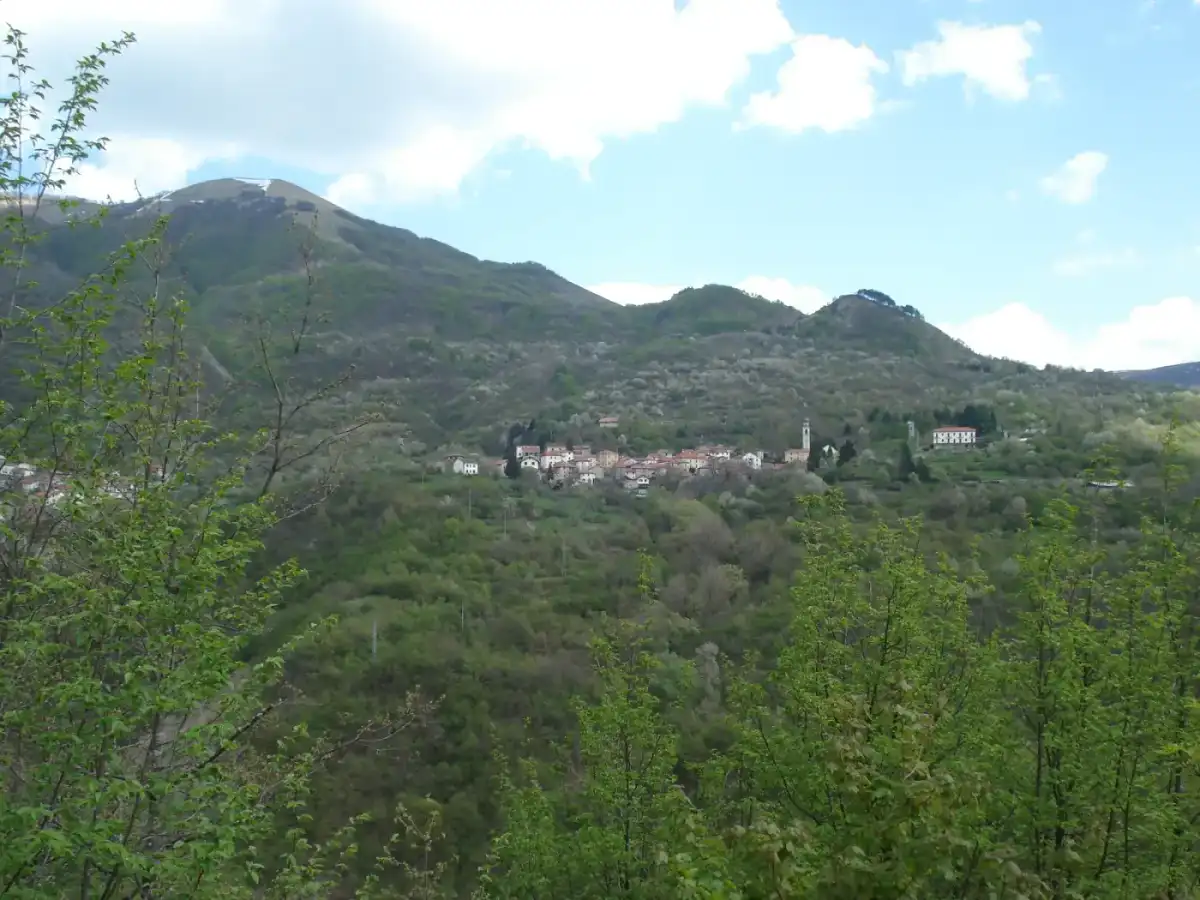
Carrega Ligure (Carriage in Piedmontese, Carêga in Liguria, which means "sedia") is an Italian municipality of 77 inhabitants[1] located in province of Alessandria in the Piemonte.
It is the only municipality of the valley included in the Natural Park of Alta Val Borbera, established on 27 March 2019[4].
Landscape and area
DistancesExplore this chapter
The municipality is located at the south-eastern end of the region on the Apennine Ligure, in the upper Borbera valley. It is one of the three common Piedmontese, with Fabbrica Curone And Cabella Ligure to border with the Emilia-Romagna Region, and the only one to confine both to Emilia-Romagna and Liguria.
With about 1.5 inhabitants/km2 it is one of the municipalities in Italy with less population density, the first among those not located on the Alps and many uninhabited fractions are situated in the small valley of the Campassi.
Distances
Carrega Ligure, while in province of Alessandria, is located at 85 km from the capital and 58 km from Genoa, with which it has historical, cultural and linguistic links. In Carrega, in fact, the Ligurian is still spoken.
History of Carrega Ligure
Marchesi di Carrega (1547-1797) · SymbolsExplore this chapter
The parish church of San Giuliano was built around the 13th century, but several times restored. It has three aisles, it is decorated with fine stucco and preserves a remarkable marble altar.
The municipality was tied for centuries to trade along the way of salt and to Imperial Feudi, was indirectly linked to the Republic of Genoa for centuries. From 1797 to 1805 it became part of the Ligurian Republic, then of the Napoleonic Empire until 1814 and from 1815 to the Kingdom of Sardinia in the Division of Genoa and in Province of Novi. From 1859 he passed to province of Alessandria.
The Malaspina Fieschi Doria castle, of which few high ruins remain on the town, had the typical Ligurian shape of the castle built around a tower. The round tower is preserved surrounded by a circular wall with walking. Addited to the tower there is a rectangular body formed by two rooms, one of which still retains the ceiling.
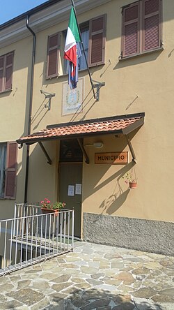
Carrega Ligure took considerable importance during the Italian Resistance. A building of the commune, marked by a plate, was located in 1944-1945, of the Command of the VI Ligurian Partisan Zone and also hosted the components of several Allied English and American missions. The different fractions that make up the Municipality of Carrega Ligure were invested in that two years also by some Nazi-fascist rallies: for antipartisan operations, the Turkestan Division was mainly used (in German: Turkistanische Legion) of the Wehrmacht composed of former Soviet, Mongolian and Turkestan prisoners[5] who heavily infiltrated the population with rubies, abuses and violence on women.
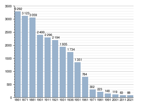
In the post-war period Carrega, which counted more than 2 000 inhabitants, suffered a rapid and unstoppable process of depopulation, mainly caused by the very reduced birth typical of Liguria and Piemonte. Sino was not connected to the valley floor by any road in 1963. The journeys took place on foot, back of mule crossing the river Carreghino several times, or with the Leaning, sleds pulled by oxen. The opening of the carriage road, paradoxically, accelerated the process of depopulation towards the cities typical of the period, as the territory was characterized by a peasant population and subsistence agriculture.
Only in recent years the municipality has experienced a small recovery, linked in particular to tourism, hiking and nature resources. However, with regard to resident citizens, the municipality has a population of about forty times lower than that which it had at the Unity of Italy.
Between 2008 and 2009, the municipality of Carrega Ligure started a project for sale of uninhabited or uninhabited houses at the symbolic price of a euro to create tourism in the country and in the future repopulate it, similarly to what happened in many other Italian countries (including Bussana Vecchia and Salemi). On 11 January 2009, the houses listed in collaboration with the University of Genoa were 720 and the requests accepted 400.[6] In the following years, despite the success of the operation, the bureaucratic complexity and the fact that the legitimate owners were scattered around the world, made the administration from the project to exist,[7] that you are then limited to reporting some sales ads on the institutional site.[8][9]
In the municipality is home to the Museum of Popular Culture of Alta Val Borbera which exhibits about 500 tools, furniture and furnishings of various kinds, documenting the life and techniques of work of agriculture and breeding over the past centuries and aims to preserve the memory of agricultural techniques now completely abandoned.
Marchesi di Carrega (1547-1797)
In 1547, with Andrea Doria's investiture at Marquis de Carrega by Emperor Charles V became part of the Imperial fiefdoms under the control of the Genoese family of Doria.
- Andrea Doria (1547-1560)
- Pagano Doria (1562-1574)
- Gian Andrea Doria (1575-1606)
- Gian Andrea Colonna Doria (1613-1638)
- Gian Andrea Doria II Landi (1638-1641)
- Maria Polissena Doria (1641-1648)
- Andrea III Doria Landi (1648-1654)
- Gian Andrea Doria III Landi (1654-1655)
- Violante Doria Lomellini (1655-1679)
- Gian Andrea Doria III Landi (1679-1743)
- Gian Andrea IV Doria Landi (1743-1764)
- Andrea IV Doria Landi Pamphili (1764-1794)
- Gian Andrea V Doria Landi Pamphili (1794-1798).
Symbols
The castle recalls the one built by Malaspina in the 12th century on the top of Mount Carmo to control the transit towards Val Trebbia and Lombardy and now reduced to a few remains. In the head are flanked by the emblems of Genoa/Alessandria and that of Savoia/Sardegna in reference to its past.[11]
The municipality has no official flag, but the flag is used with the red cross in white field, which recalls the Ligurian identity and the historical bond with Genoa.
Society
Demographic evolutionExplore this chapter
Demographic evolution
Inhabitants registered[12]
Administration
Below is a table relating to the administrations that have succeeded one another in this municipality.Explore this chapter
Below is a table relating to the administrations that have succeeded one another in this municipality.
| Period | First citizen | Match | Load | Notes | |
|---|---|---|---|---|---|
| June 24, 1985 | May 26, 1990 | Sergio Crosetti | civic list | Mayor | [13] |
| May 26, 1990 | April 24, 1995 | Sergio Crosetti | Italian Socialist Party | Mayor | [13] |
| April 24, 1995 | June 14, 1999 | Fausto Asborno | centre-left | Mayor | [13] |
| June 14, 1999 | June 14, 2004 | Fausto Asborno | Democratic Union | Mayor | [13] |
| June 21, 2004 | 5 April 2005 | Mountain enrolment | - | Prefectious Commissioner | [13] |
| 5 April 2005 | March 30, 2010 | Guido Gozzano | civic list | Mayor | [13] |
| March 30, 2010 | May 31, 2015 | Guido Gozzano | Civic list Democratic Union | Mayor | [13] |
| May 31, 2015 | September 20, 2020 | Marco Guerrini | Lista civica Tradizione e futuro in Cariega | Mayor | [13] |
| September 20, 2020 | in office | Luca Silvestri | Lista civica Tradizione e futuro in Cariega | Mayor | [13] |
Image gallery
Explore this chapter
-
 The tombstone dedicated to Anton Ukmar in Carrega Ligure, put by the ANPI section of Genoa
-
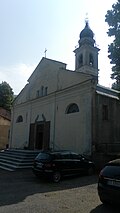 The church of San Giuliano
-
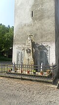 The monument to the fallen
Notes
Explore this chapter
- ^ to b Monthly demographic balance for the year 2026 (provisional data), up demo.istat.it, ISTAT.
- ^ Seismic classification (XLS), up risks.protezionecivile.gov.it.
- ^ Table of degrees/day of Italian Municipalities grouped by Region and Province (PDF), in Law 26 August 1993, n. 412, annex A, National Agency for New Technologies, Energy and Sustainable Economic Development, 1 March 2011, p. 151. URL consulted on 25 April 2012 (archived fromoriginal url on 1 January 2017).
- ^ Regional Law no. 11 of 27 March 2019 on the site of the Region Piemonte
- ^ Giovanni Rossi, The Borbera Valley in the Resistance 1943-1945, Serravalle Scrivia, Tipografia Frascarolo Arnaldo, 2005.
- ^ The abandoned houses for sale at a euro, in The 19th Century, 11 January 2009.
- ^
 Carrega Ligure Houses for sale at 1 euro from TG3 of 02-08-2014, up YouTube, Google LLC.
- ^ Carrega Ligure, Houses at 1 euro, up commoncarregaligure.eu.
- ^ Municipality of Carrega Ligure, Real estate ads, up common.carregaligure.al.it.
- ^ Piedmontese civic coat of arms, vol. I, Regional Council of Piemonte, 2016, p. 111, ISBN 978-88-96074-98-5.
- ^ Carrega Ligure, up araldicacivica.it. URL consulted on 22 October 2021.
- ^ Data taken from:
- Resident population of the municipalities. Censuses from 1861 to 1991 (PDF), up ebiblio.istat.it, ISTAT.
- Resident population - Time series, up exploredati.istat.it.
Please note: 2021 data refers to permanent census data as of December 31 of that year.
- ^ to b c d And f g h the http://amministratori.interno.it/
Where to stay · Carrega Ligure
Find stays on Booking.comStories, places and people
More about Carrega Ligure and the surrounding area
Follow a thread of history and see where it leads.
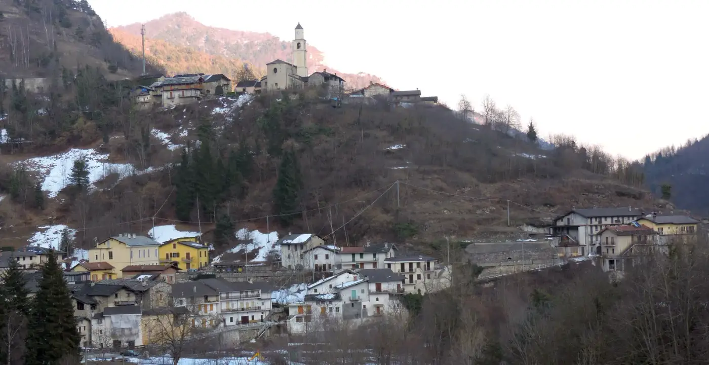
The area, step by step
Trails and routes in Carrega Ligure

Asti, Alessandria and surroundings
Sentiero cosola - daglio
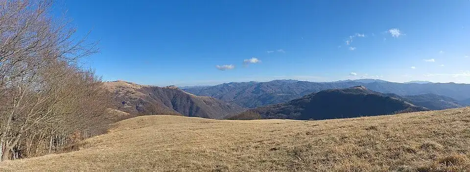 WalkingAround the starting point
Asti, Alessandria and surroundings
Anello borbera - spinti tappa 07 (capanne di carrega - monte antola)

Asti, Alessandria and surroundings
Sentiero i villaggi di pietra (vegni - croso)
 WalkingAround the starting point
Asti, Alessandria and surroundings
Sentiero berga - sella banchiera
Asti, Alessandria and surroundings
Sentiero vegni - passo tre croci

Asti, Alessandria and surroundings
Sentiero reneuzzi - sella banchiera
Asti, Alessandria and surroundings
Sentiero vegni - sella est monte antola
Asti, Alessandria and surroundings
Sentiero campassi - casoni di berga


Asti, Alessandria and surroundings
Sentiero pian degli orsi - bivio sentiero 258
 WalkingAround the starting point
Asti, Alessandria and surroundings
Sentiero daglio – carrega ligure

Asti, Alessandria and surroundings