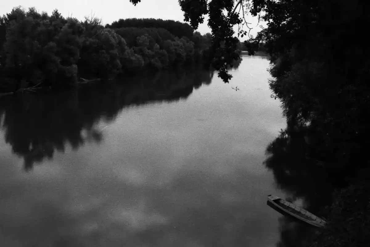
A closer look
Tanaro: at a glance
The Tànaro (Tana in brigasco, Tòn-no in homicide, Tânar, Tan or Tani in Piedmontese, Tànau, Tànaru, or Tàna incidento in Liguria, Tànnôu in Genoese) is the second river by length of Piemonte after the Po, of which it is also main tributary of right.[3]
It is one of the largest rivers in Italy: sixth by length (276 or 290 km) after Po, Adige, Tiber, Adda and Oglio, and fourth by the width of the hydrographic basin (8.175 km2) after Po, Tevere and Adige. Possessing the longest river in Italy, which measures over 700 km between the source of the Negrone stream (the Tanaro spring) and the mouth of the Po River in the Adriatic,[4] the Tanaro should be correctly considered as the longest river with the course entirely in Italian territory.[5]
The name
Tanaro and PoExplore this chapter
The name Tanaro can be associated with the Celtic theonym "Taranus" and the British "Taran" (temporal, thunder, god of temporal) or to a hydronimic prelatina root "Tan".[6][7] See also the French Tarn (fiume).
Tanaro and Po
Since the Tanaro to the confluence with the Po measures 276 km (about 290 km taking into account also the sources of the Negrone stream[8]) compared to the 230 km that it traveled at that point Padus (the Po, in fact), according to the use of ancient geographers it should keep its name up to the Adriatic Sea. The Tanaro would thus be considered, with approximately 700 km in length, the longest river in Italy; However, the geographers themselves were not aware of this fact[9][10]. Some scholars today, taking note that the longest river in Italy is the Negrone-Tanaro-basso Po, have hypothesized the possibility of redefining the hydronyms of the Valley Padana[5]. However, it should be remembered that at least four other tributaries of the Po at the point of their confluence have a river upstream that is longer than the Po itself at the point of confluence. These are in particular Pellice/Chisone, Varaita, Maira/rio del Maurin and Dora Baltea/Dora di Val Ferret[5].
River course
Tanaro was born at the south-western end of the Piemonte on the border with Liguria, in the Ligurian Alps . It is formed in fact to the confluence of the Tanarello and Negrone torrents...Explore this chapter
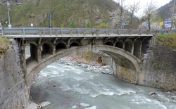
Tanaro was born at the south-western end of the Piemonte bordering Liguria, in the Ligurian Alps. It is formed in fact to the confluence of the Tanarello and Negrone streams on the border between the municipal territory of Ormea (CN) and that of Cosio d'Arroscia (IM).
More precisely the Tanarello is born from Mount Saccarello (2.201 m), the highest peak of Liguria, and flows for about ten kilometers - of which the first 4 km in Piedmont and the remaining in Ligurian territory (common of Cosio di Arroscia) - in a valley with typical Alpine counties, then reaching 4 km upstream of the village of Ponte di Nava (fraction of Ormea), where it receives from left the contribution of Negrone, a stream that is born instead in Piedmontese territory from Cima Missun (2356 m), not far from Punta Marguareis (2.651 m). Del Negrone also needs to remember the characteristic of some resurrections at the foot of the karst massif of Marguareis-Mongioie, where in tunnels and tunnels we collect rainwater, which then flows with imposing waterfalls in the throat of the Fascettes and the Vene del Tanaro.
From this confluence between Tanarello and Negrone upstream of Ponte di Nava the river doubles in size and changes name becoming Tanaro, thus heading towards the north-east as a foaming Alpine river in a narrow and wooded valley and acting for a few kilometers as a border between Piemonte and Liguria. Once the town of Ponte di Nava was bathed and received from the right the Rio dei Boschetti (or Rio Nava), the river definitively enters Piedmontese territory reaching Ormea where it receives various tributaries such as the Rio Chiappino, the Armella stream, which originates from the Pizzo d'Ormea lake, and the Rio Peisino. The water flow in this stretch suffers some drops due to artificial withdrawals (the annual average is around 6.9 m³/s).
Further downstream, after wet the municipality of Garessio receiving from the left the Rio Inferno and the Rio Luvia and from the right Rio Bianco and the Rio Malsangua that flows between two bridges, the one of the mid-nineteenth century red bricks («corticato» from the flood of November 1994, then demolished in 2020[11]) and that of the Amitiè at the end of the twentieth century (overwhelmed by the waters and rebuilt with a higher arch), the river then begins to flow for a few kilometers in a large flat basin surrounded by the peaks of the Ligurian Alps, shortly reaching the municipality of Priola and then that of Bagnasco where an evocative medieval stone bridge crosses it (it was partly destroyed by the aforementioned flood and then rebuilt thanks to the «Maurizio Costanzo Show»); its flow rate is now 9.1 m³/s.
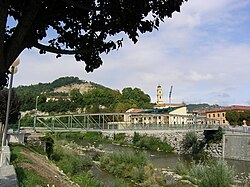
From here onwards the valley narrows again and the river turns sharply towards north-west, first entering the suggestive ingola stretch of the Gorge of the Rocchini and then wet, once outside, the town of Ceva, where it receives from the right the river Cevetta. From this point onwards, the Tanaro applauds its race by losing part of the famous torrents, and the Alpine aspect of the valley changes deeply because it is the same river now that the Langhe hilly complex has been lambire.
From here the river continues towards the north, creating a gap between rough hills reaching the centre of Castellino Tanaro with an average flow of 12.40 m3/s. In this section his bed is deeply recessed between the reliefs of the Langhe and theMonregalese plateau, digressing in a very irregular way and creating, now on one bank, now on the other, suggestive gullies of erosion and also changing the color of its waters (up until now transparent) which now become muddy due to the clayey nature of the valley's soils.
Once in Lesegno receives the first important left tributary: the torrent Corsaglia (average over 10 m3/s) after which, disembarked from a dam, yields all its scope for hydroelectric purposes, remaining completely dry for about 1 km. Recaptured the water flow, another dam near Niella Tanaro drains again the river for a few kilometers. In Bastia Mondovì (an average annual flow of 29 m3/s), another dam once again subtracts all the water to the river for a few kilometers. At the same time, various tributaries come to the river, including the Hella (average 5 m3/s), the Pesio (media 10 m3/s) and the Mondalavia which increase the volume of Tanaro water.
In Clavesana the river is still a remarkable water loss twice in a few kilometers: first it is partly drained to supply a channel that once fed the local oil mill, after which, regained the entire flow of water through a large discharge mouth, is again disembarked a few hundred meters downstream from a big dam to bulk for food. For a few kilometers his bed returns almost dry.
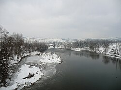
The same scenario is resurfaced more downstream several times as near Farigliano, where the river now has an annual average flow of 38.70 m3/s, for a short stretch in Monchiero, up to the confluence of the Rea stream (average 1.7 m3/s) and, even further downstream, in Narzole where the water is held by a large dam. Despite the massive use of its waters, the Tanaro takes on more and more the characteristics of the river itself, continuing northwards with winding trend and increasing its bed.
Once in Cherasco with an average annual flow of 41 m3/s, the river bends eastward and flows the Stura di Demonte, a very rich river of water (average 36 m3/s), its main left tributary (115.4 km). From here onwards the Tanaro changes its appearance with its valley that becomes very wide (also 3–4 km) and its bed which expands considerably, sometimes branching out into various secondary arms; the water flow doubles by touching the 80 m3/s; in this section the river wet Pollenzo, formerly a Roman city of which some vestiges remain, and, disembarked from the eternal dam, goes to feed the Canal of Verduno.
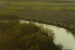
Once in Alba receives both from right and left the contribution of modest torrents: the Rio de la Gera, the Mellea and the Riddone from the modest heights of Roero, Talloria (1.8 m3/s), Cherasca (0.7 m3/s) and Seno d'Elvio, coming instead from the Langhe. With a wide and pebbly bed the river reaches Castagnole delle Lanze And San Martino Alfieri by entering so into Astesana (and also in province of Asti): here it crosses the southern outskirts of the Asti receiving from the left the Borbore (9,5 m3/s), the Rio Valmanera and the Versa (3,5 m3/s), water streams draining all the astigian portion of the basin.[12]
In short wet the centers of Castello di Annone And Rocchetta Tanaro, after which it enters province of Alessandria the municipalities of Masio (where it receives the stream from the right Tiglione) e Felizzano, where a last large dam exploits its waters, thus beginning its plain course closed between two high embankments.
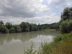
At the Villa del Foro from the right the hipposes before the Belbo (95 km and annual average of 8.1 m³/s) and the Canal Carlo Alberto (which drains a small part of the waters of the Bormida) after which it is preparing to cross the city of Alessandria, with an average annual flow close to 90 m³/s, also receiving the last albeit small tributary on the left: the Rio Nuovo di Loreto.
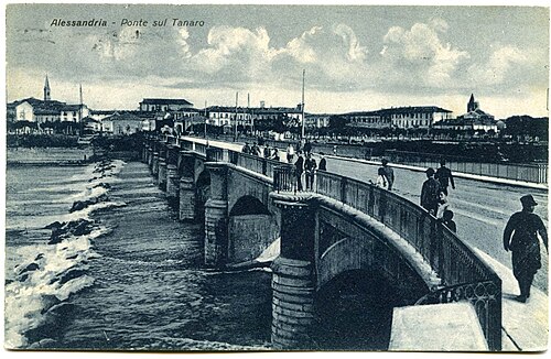
Arrived at Pavone d'Alessandria, fraction of Pietra Marazzi, a few kilometers downstream from the city of Alessandria, the river laps at the base of the last offshoots of the Monferrato creating a very suggestive scenario made of harsh erosion walls on the left bank, lanche, large tree-lined golenes, fields cultivated in the right bank.
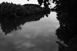
Here the Tanaro receives its greatest tributary of right: the Bormida (154 km and over 33.2 m³/s annual average) which, excluding a small portion to the west of its upper basin in the province of Savona, drains almost the entire Apennine part of its large basin.
After this last confluence the average annual module of the river increases again reaching values among the most important among the tributaries of the Po (116,2 m3/s), comparable almost to those of the Oglio and lower only to those of Ticino and Adda, all rivers however of Alpine origin.
From the confluence the river continues lazy with wide meanders, lapping the feet of the hill Montecastello. We are now in the open plain, even if the river almost does not seem to want to completely "abandon" the Monferrato hills, stubbornly continuing to lap them on the left bank. Here it becomes navigable up to the mouth by small boats (except in summer).
Finally, the scope of the municipality Rivarone the Tanaro passes under the bridge Bassignana and with a last effort it covers the last kilometre course and then flows into the Po, without immediately being able to confuse its limacciose waters with the grey-green ones of the latter.
Affluents
Hydrographics · Hydrographical LeftExplore this chapter
The large Tanaro basin includes numerous tributaries (in brackets the place of confluence of each of them):
Hydrographics
- torrent Tanarello - branch of right spring
- Rio dei Boschetti[13], which originates near Colle di Nava (municipality of Pornassio) and flows into the Tanaro in the Ponte di Nava area.
- rio di Prale (Ormea)
- Rio dei Bossi (Ormea)
- Rio Bossieta (Ormea)
- Rio La Valle (Ormea)
- Rio Barchi (Ormea)
- Rio Bianco (Garessio)
- rio Malsangua (Garessio)
- torrent Cevetta (Ceva)
- torrent Rea (Monchiero)
- torrent Cusina (Rocca Cigliè/Castellino Tanaro)
- torrent Talloria (Alba)
- torrent Cherasca (Alba)
- Seno D'Elvio stream (Alba)
- torrent Tiglione (Masio)
- torrent Belbo (Villa del Foro)
- channel Carlo Alberto (Villa del Foro)
- Bormida river (Montecastello)
Hydrographical Left
- torrent Negrone - branch of left spring
- rio Chiappino (Ormea)
- stream Armella (Ormea)
- Rio Peisino (Ormea)
- Rio Inferno (Garessio)
- rio Luvia (Garessio)
- torrent Corsaglia (Lesegno)
- torrent Ellero (Bastia Mondovì)
- river Pesio (Bastia Mondovì)
- stream Mondalavia (Narzole)
- river Stura di Demonte (Cherasco)
- rio Laggera (Pollenzo)
- rio Mellea (Santa Vittoria d'Alba)
- Riddone stream (Alba)
- stream Borbore (Asti)
- Rio Valmanera (Asti)
- creek Versa (Asti)
- Rio Nuovo di Loreto (Alessandria)
Paleogeography
About 100,000 years ago the Palaeo-Tanaro in its valley section of Ceva headed north and flowed into the Po in the area where today stands Carignano (TO). The subsidence...Explore this chapter
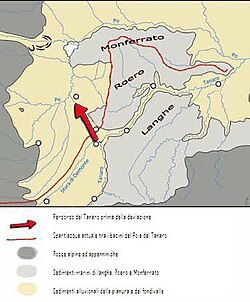
About 100,000 years ago the Palaeo-Tanaro in its valley section of Ceva headed north and flowed into the Po in the area where today stands Carignano (TO). The subsidence of the astigiano-Alessandrin area and erosive action of small watercourses flowing between Asti and Bra stretched up the basin of the latter, capturing the river and moving its confluence into the Po in the present position, located near the Bassignana (AL).[14] This phenomenon of capture gave, among other things, the area of Rocche del Roero, characterized by spiers and gullies elsewhere rather rare in Piemonte.[15]
Hydrological system
Monthly average portExplore this chapter
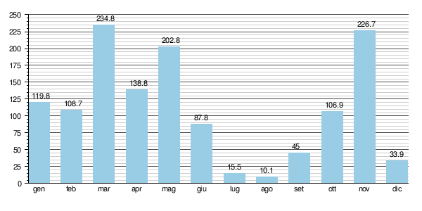
The Tanaro differs from the other tributaries of the Po being characterized by a complex regime, practically halfway between the counties of the Alpine and the Apennines rivers, being its basin distributed partly on the mountain chain and in part on the Apennines.
The river has two peaks full during the year (the spring and autumn attic) with the late spring-spring greater than the autumn (common feature of the Alpine rivers) and two peaks of lean (summer and winter) with the summer much more accentuated than the winter (as happens instead for the Apennines rivers).
In any case the Tanaro basin is very vast and therefore has many different water characteristics depending on the various sections of its course:
- 1st Section: source (Alpi Liguri) - Ceva
- In this section, the river has a nearly alpine regime, with rich flowing in late spring for melting snow on the Ligurian Alps and summer and winter magre. Differences between full and lean flow are not exemplary.
- 2nd Section: Ceva - Cherasco
- In this portion, however, the Tanaro regime becomes pluvio-nival with maximum flow rates in autumn (due to strong rainfalls that during this period affect the Monregal plateau and especially the Langhe) and in spring (for melting of snow) with the spring peak slightly greater than the autumn.
The magre instead follow the typical trend of the Apennines rivers, with the summer lean much more marked than that winter.
- 3rd Section: Cherasco - mouth in the Po
- In this last portion the river, while greatly increasing its flow, has a pluvious-nival regime even more accentuated with 2 peaks of full year:
- autumn (October-November), mainly due to the contributions of the aforementioned medium-upper section of the river and the many torrents and streams coming from the reliefs of Langhe, Roero and Monferrato (Rio della Gera, Mellea, Riddone, Talloria, Cherasca, Seno d'Elvio, Borbore, Versa, Tiglione...), affected in this period by heavy rainfall.
In the short final stretch from Alessandria to the mouth in the Po the autumnal floods are even more frequent and imposing due to the further contribution of the Belbo and especially of the Bormida (both rivers with pluvial character, with basins arranged almost totally on the highly waterproof lands of Langhe and high Monferrato). - Late spring (May-June), is much higher than the autumn one (it can even reach values of 300–400 m³/s) and is largely due to the contribution of the Monregalese rivers and above all to the very substantial one of the Stura di Demonte following the melting of the snow from Colle della Maddalena.
The most important are in winter (December-February) and especially in August where, especially in the downstream section of the confluence with the Stura di Demonte, the flow is reduced almost to a 1/4 of the annual average, once again as in the Apennine rivers.
- autumn (October-November), mainly due to the contributions of the aforementioned medium-upper section of the river and the many torrents and streams coming from the reliefs of Langhe, Roero and Monferrato (Rio della Gera, Mellea, Riddone, Talloria, Cherasca, Seno d'Elvio, Borbore, Versa, Tiglione...), affected in this period by heavy rainfall.
Monthly average port
Hydrometric station: confluence Po (1951 - 1991)
Hydro-geological asset
The Tanaro is characterized by the imponence of its full seasonal ones that can easily reach values of 2.000 m3/s.Explore this chapter
The Tanaro is characterized by the imponence of its full seasonal ones that can easily reach values of 2.000 m3/s.
The same river also has a remarkable erosive and transport capacity with relatively short travel times (if compared to the considerable length of the main auction) in case of heavy rainfall: in case of formation of a full upstream wave (Ormea area) it is necessary 24-28 hours before the latter reaches the mouth in the Po a Montecastello.
From this it is evident how the whole basin of the river is rectified by a very fragile balance as distributed on extremely delicate territories from the hydrogeological point of view, often subject to remarkable phenomena of dissect (smottings, landslides, erosions, washing...).
The situation then becomes even less comforting, including the process of urbanization to say little savage occurred in the seventies along the banks of the river characterized by artificial channellings of wide sections of river and its tributaries, occupation of much of the gorge territories and uncontrolled sbanking of the gravel from the river bed.
Floods
Full and flood of 5-6 November 1994 · Other floods and significant floods · Full of 27-28 April 2009Explore this chapter
Several times over the centuries Tanaro and its tributaries have caused more than one problem to human settlements located along their shores as in the autumn of the 1948, of 1968, of 1994, of 2016, of 2020.
Full and flood of 5-6 November 1994
The disaster that struck the river basin occurred on 5-6 November 1994, after three days of continuous rain (over 600 mm): a wave of extraordinary flood of the river in fact formed on 5 November upstream of Ormea and running down to the valley devaded with unhearded fury all its course and dozens of inhabited centers along its banks until reaching the mouth in the Po in the first hours of the day 7 November.
During the alluvial event, Tanaro touched record values never achieved in the century:
- at the Farigliano hydrometer the river touched the exceptional height of 9 meters (well 3 meters above the previous historical level) with a reach of 3,400 m3/s;
- in Alba, Asti And Alessandria the width of the full was between 4,000 and 4,200 m3/s;
- to the hydrotro Montecastello, a few kilometers before the confluence with the Po it touched 5,000 m³/s with 8.50 m.
Particularly shocked by the alluvial event, the whole stretch between the municipality of Ormea and the confluence with the Stura di Demonte near Cherasco, where Tanaro almost totally destroyed most of the civil artifacts present there (inhabitations, bridges, roads...), changing also for ample stretches in a definitive way the physiognomy of its bed and valley floor [16].
The municipalities involved in the flood were:
- Cosio di Arroscia, in Case d'Isole, in Province of Imperia
- Ormea, Garessio, Priola, Bagnasco, Nucetto, Ceva, Bastia Mondovì, Clavesana, Farigliano, Piozzo, Lequio Tanaro, Monchiero, Narzole and Alba in the province of Cuneo;
- Asti, Castello di Annone, Cerro Tanaro And Rocchetta Tanaro in the province of Asti;
- Solero, Felizzano, Alessandria And Pietra Marazzi in the province of Alessandria.
Particularly affected were the cities of Ormea, Garessio, Ceva, Alba and Asti, flooded for 1/3 of their surface and above all Alessandria, a city that was almost 50% submerged and which also saw 11 people die. In the Case d'Isole area, in the municipality of Cosio di Arroscia, the collapse of the medieval Isole bridge, with a single arch, which connected the two banks of the Tanarello, occurred.
Other floods and significant floods
Full of 27-28 April 2009
On 27-28 April 2009, Tanaro recorded an extraordinary wave of great intensity. The river level reached 5.39 m above hydrometric zero at Asti and exceeded the risk threshold at the Montecastello hydrometric station, where a maximum level of 7.24 m was recorded, with a flow rate of about 3200 m3/s.[17] According to the report of ARPA Piemonte, taking into account the mitigating effects of hydraulic works built in recent times and the contributions of torrents Belbo And Bormida, the flood event was the most severe on the river after that of November 1994.[18] The river has exonerated for vast stretches between Solero and Casalbagliano, also involving residential and industrial settlements. 6,000 people were evacuated from the neighborhoods Vegetables And Citadel of the Alessandria. Further flooding occurred in province of Alessandria in the municipalities Masio, Felizzano, Solero, Pietra Marazzi, Montecastello, Rivarone, Piovera, Bassignana.[18] There have been some floods in the municipality of Asti.[19]
Full and flood of November 2016
On the morning of 24 November 2016, due to abundant rainfall from 20 November, the river level has suddenly increased upstream of Ormea and the consequent floods have created serious damage throughout the valley, road and rail system, to civil and industrial buildings. The SS 28 was blocked by Ceva to the Piedmont-Ligure border between Ormea and Pornassio to Ponte di Nava. The roads between Ponte di Nava and Viozene and Briga Alta, in whose territory there are the sources of Tanarello and Negrone (the two branches from which the Tanaro was born), have been destroyed in several places by huge lands and droughts, that put in grave danger the settlements of Monesi and Piaggia. In the main square of Ormea, the stream Armella, tributary to the left of Tanaro, opened 3 sinks swallowing a car; an entire condo overlooking the creek was evacuated. In Garessio the central bridge General Odasso and the adjacent streets were submerged by the river. Much of the city of Ceva was invaded by waters. Numerous bridges along the course of Tanaro, up to Alessandria, they were closed precautionaryly. In the late evening of 24 November rainfall has returned to intensify and the level of the river has reached the highest levels and full destructive power. The flow has reached - at 23:30 of the 25 November - a maximum full of 6,68 meters on the hydrometric zero, about one meter lower than the historical one of 1994 (estimated at an approximate share of 7,60 Meters).[20][21][22] Advertisement Alessandria Tanaro made the city's flooding dread in the night between 25 and 26 November.
Full and flood of October 2020
On the night between 2 and 3 October 2020, following rainfalls that lasted just from morning and which insisted with violence especially on the sources of Tanarello and Negrone in the Saccarello massif - Marguareis, the flood reached Ponte di Nava and the consequent massacres created very serious damage throughout the high valley. Ormea has been completely isolated: upstream there was an imposing stretch between Ponte di Nava and Cantarana that occupied the entire highway 28, while downstream the waters of the Peisino rio invaded the road with rocks and debris, cutting the main and only way of communication with the rest of the Piemonte. The provincial road between Ponte di Nava and Viozene has been destroyed in several points. The historic center of Ormea was invaded by the waters and debris transported downstream from the river Armella, crossed for over two meters high by its own argini upstream of the town. The roads and the cycle path adjacent to Tanaro were destroyed in several points, private houses and activities were flooded and deeply damaged. The tributary rites of Tanaro, like the Chiappino rio, have broken the clays and destroyed the municipal roads that connect some fractions to the capital. Some bridges along the river have been wiped out or deeply damaged. Much of the country's hiking network has been severely impaired by landslides, displacements, bridge destruction and guds by Tanaro tributaries.
In Garessio the central bridge General Odasso and the adjacent streets were again submerged by the river and debris transported, not even four years away from the flood of 2016, flooding shops and private houses.
The part of the city of Ceva adjacent to the river was invaded by the waters and severely damaged. The flow reached - at 22:00 on October 2 - a maximum of 5.32 meters on the hydrometric zero in Ponte di Nava and 5,93 meters in Garessio.
The hydrometric stations have detected the floods :
- In Ponte di Nava, a hamlet upstream of Ormea, the full wave was 5.32 meters.
- At Garessio the maximum wave of full was 5,93 meters.
- In Farigliano the flood was 6.22 meters.
- In Alba the full was 4,97 meters.
- Advertisement Asti the full has reached 5.54 meters.
Fauna
Among the species that go up this river to reproduce there is cheppia (Alosa fallax ).Explore this chapter
Among the species that go up this river to reproduce there is cheppia (Alosa fallax).
Notes
Explore this chapter
- ^ AA.VV., CALENDARIA ATLANTE De Agostini 2014, Novara, De Agostini, 2014, ISBN 88-511-1828-0. Retrieved 20 April 2014.
- ^ to b AA.VV., Processed I.c/7 (PDF), in Water Protection Plan - Review of 1 July 2004; Characterization of hydrographic basins, Region Piemonte, 1 July 2004. Retrieved 12 December 2013 (archived fromoriginal url on 3 March 2016).
- ^ AA.VV., 9 From Ceva to Imperia for the Colle di Nava, in Piemonte (not included Turin), series Guide of Italy, Italian Touring Club, 1976, p. 266. Retrieved 2 March 2023.
- ^ The river of wine, the Tanaro, casts the Po from the throne, up Acquabuona Rivista enologica online, 18 January 2012. Retrieved 14 August 2019.
- ^ to b c Giovanni Badino, The long water route (PDF), in Speleology, December 2015, pp. 54-59. Retrieved 28 October 2017.
- ^ Celtic toponimi of Italy
- ^ Carlo Antonio Vanzon, Universal dictionary of Italian language, Livorno, Vannini Editore, 1842, p. Volume VII, page. 381.
- ^ The Negrone is a little less than 14 km long, see Site of the Po River Basin Authority (archived fromoriginal url on 14 May 2009).
- ^ Fulvio Basteris, Garessio yesterday and today, 1988, p. 9
- ^ A classic example of the river longer but with less flow to which is attributed the river auction downstream of the confluence with a shorter river but with greater scope is that of Kama and Volga: the latter, while having a smaller flow, maintains its name in force of its greater length at the point of confluence.
- ^ Garessio: the Odasso bridge no longer exists, up www.provinciagranda.it. Retrieved 15 February 2023.
- ^ Enrico Ercole, The Tanaro: places, functions and social actors of the river in Asti (PDF), in Giorgio Osti (ed.), Water courses of the Upper Adriatic, Rivers and cities. A distance love, Volume I, 1st ed., Padova, Padova University Press, 2021, pp. 237-245, ISBN 978-88-6938-254-3. Retrieved 12 February 2025.
- ^ Regional map in scale 1:25,000 of the Liguria Region, online on www.cartografiarl.regione.liguria.it. Retrieved 25 September 2017 (archived fromoriginal url on 29 May 2017). (consulted in September 2017)
- ^ The metamorphosis of the earth. As water, air and fire shape the face of our planet, Augusto Biancotti, Giunti Editore, Florence 1995; pages 22 and following.
- ^ Giacomo Bassi, Sara Cabras, Remo Carulli, Cinzia Rando, Anita Franzon, Piemonte, EDT, 2018, ISBN 9788859247623. Retrieved 17 March 2022.
- ^ Luino Fabio, Arattano Massimo and Brunamonte Fabio, "Vulnerability of urban areas to flooding: events in the North-West Italy, November 1994", in . Proceedings of the Sixth National Congress and International Conference on Environmental Geology and Territorial Order, Granada, 22-25 April 1996, III, 1996, pp. 309-327.
- ^ ARPA Piemonte - Preliminary report on the meteopluviometric event of 26-28 April 2009, pages. 29-30, can be found online (PDF).[interrupted link] (PDF)
- ^ to b ARPA Piemonte - ibid., pages 42-43, can be found online (PDF).[interrupted link]
- ^ ARPA Piemonte - ibid., page 44, can be found online (PDF).[interrupted link]
- ^ Radio Gold, Alessandria dry for just 35 cm, in RadioGold, 26 November 2016. Retrieved 27 November 2016.
- ^ Alluvione 1994 and 2016 in comparison. Where are the major criticalities?, in AlessandriaNews.it - Quotidiano della provincia di Alessandria. Retrieved 20 August 2017 (archived fromoriginal url on 20 August 2017).
- ^ Quick preliminary analysis of the full Tanaro, some considerations, in AlessandriaNews.it - Quotidiano della provincia di Alessandria. Retrieved 20 August 2017 (archived fromoriginal url on 20 August 2017).
Bibliography
Explore this chapter
- Eugenio Perrone, Tanaro, Cecchini, Rome, 1916 (description and study on hydraulic driving power)
- Giovanni Rapetti, I pas ant l'èrba (edited by Franco Castelli), Alessandria, All'Insegna del Moro, 1987
- Luciano Cortevesio del Tanaro, Legend runs on the river, Gribaudo, Cavallermaggiore (CM), 1990
- Giuseppe Aldo di Ricaldone "Monferrato tra Po e Tanaro" Gribaudo Lorenzo Fornaca publisher, Asti 1999
- Richard Motta, Tanaro, Bormida and the collective unconscious of Alessandria, Maxmi Publisher, Castelnuovo Scrivia, 1995
- Ugo Boccassi, Alessandria by boat - When the Tanaro Canottieri remava, in "Nuova Alexandria" Year III N° 10, Ugo Boccassi Editore, Alessandria 1997
- Fulvio Basteris, Garessio, yesterday and today, B&B Editions, Cuneo, 2003
- AA.VV., Tanaro: a river, its world... once, Edizioni i Grafismi Boccassi for the Ethnographic Museum of Alessandria "Once Upon a Time", Alessandria, 2005
- Massimo Arattano, Fabio Brunamonte, Fabio Luino: Alluvial event of 5-6 November 1994 in Piemonte: considerations on the vulnerability of some inhabited centres. Proceedings of the 1st Conference of the National Group of Applied Geology, Giardini Naxos (ME), 11-15 June 1995, pp. 89–108, Publ. No. GNDCI: 1231, 1995
- Massimo Campora, Renato Cottalasso, Ornella Dura, Marco Grassano, The Tanaro. Illustrated guide to the landscape, flora and fauna of the Tanaro river, Muzio publisher, 2007
- Laura Calosso and Laura Nosenzo, Tanaro, the friendly-enemic river (edited by Daniela Piazza Editore) Turin
- Marina Marengo, Alta Val Tanaro. Methods and paths of construction of a mountain territory, Pacini, Ospedaletto (PI), 2011
- Roberto Moriani, To the sources of Tanaro - Between history and legend. Fusta Editore, Saluzzo 2022
Continue your journey